Bahamas Map Pictures, Images and Stock Photos
Browse 2,800+ bahamas map stock photos and images available, or search for nassau bahamas map or bahamas map vector to find more great stock photos and pictures.
Most popular
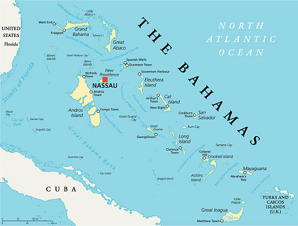
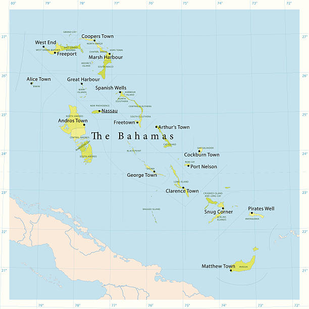
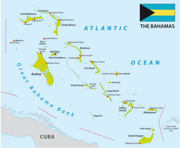
The Bahamas Political Map with capital Nassau, important cities and places. English labeling and scaling. Illustration.
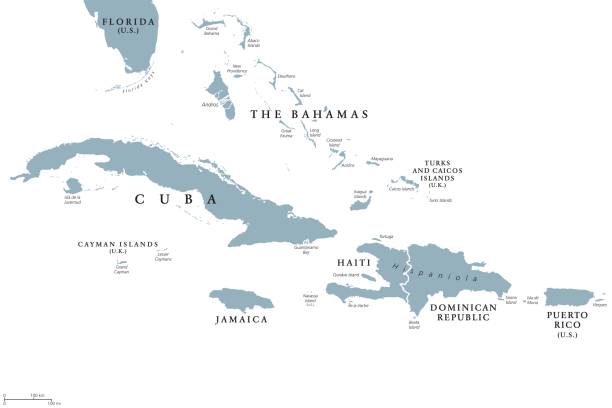
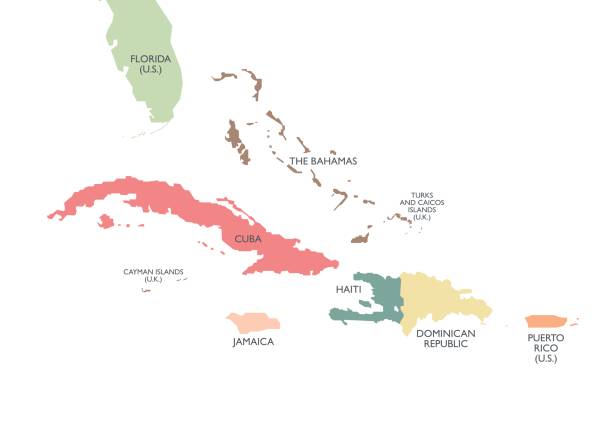
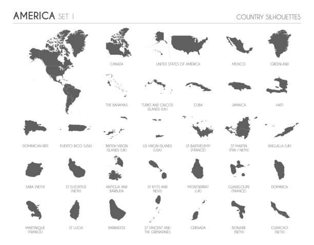
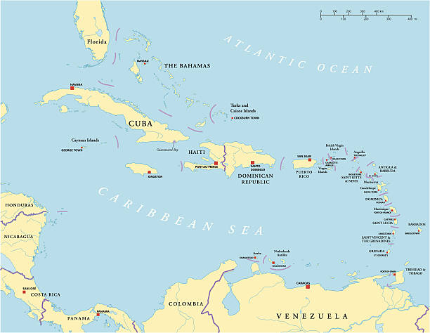
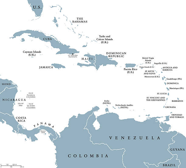
Greater Antilles political map with English labeling. Grouping of the larger islands in the Caribbean Sea with Cuba, Hispaniola, Puerto Rico, Jamaica and the Cayman Islands. Gray illustration. Vector.
![Bahamas map Bahamas map. Source: "World reference atlas"
[url=/search/lightbox/5890567][IMG]http://farm4.static.flickr.com/3574/3366761342_e502f57f15.jpg?v=0[/IMG][/url] bahamas map stock pictures, royalty-free photos & images](https://media.istockphoto.com/id/110925402/photo/bahamas-map.jpg?s=612x612&w=0&k=20&c=ZHNUxF5fNzsJDSlTtC2xLVyc_28MaFt-kLqjL0bwWCg=)
Bahamas map. Source: "World reference atlas" [url=/search/lightbox/5890567][IMG]http://farm4.static.flickr.com/3574/3366761342_e502f57f15.jpg?v=0[/IMG][/url]
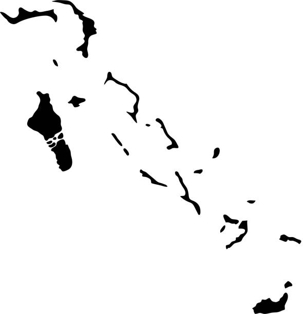
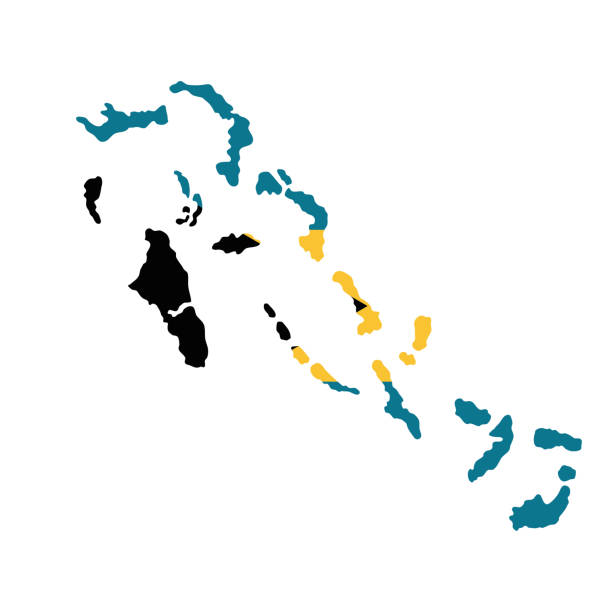
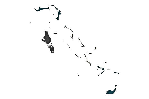
Vector isolated illustration icon with black shape silhouette of simplified map of Bahamas islands.White background with shadow
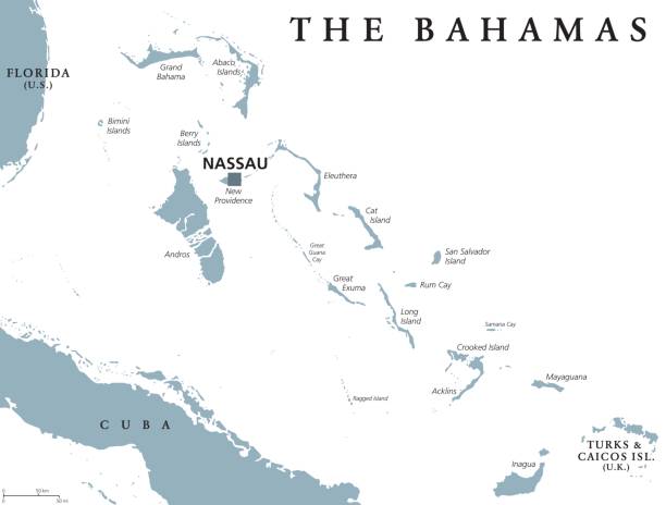
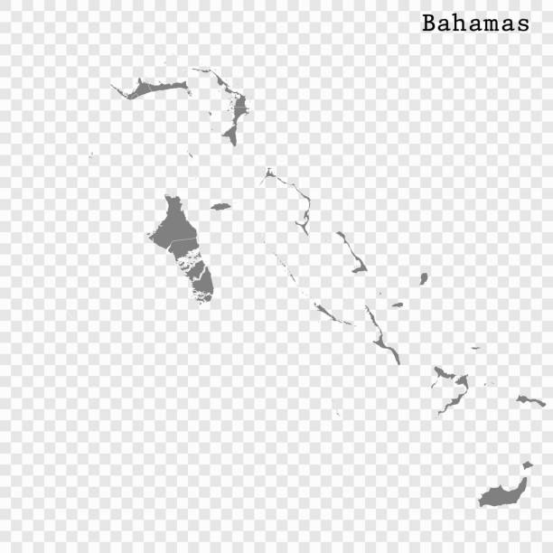
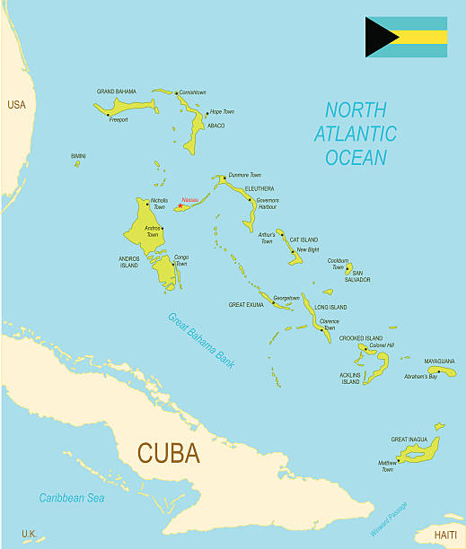
The Bahamas political map with capital Nassau. Commonwealth and archipelagic state within the Lucayan Archipelago in the Atlantic Ocean. Gray illustration on white background. English labeling. Vector

Greater Antilles political map. Vector illustration
Bahamas on a map.
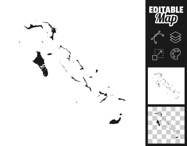
Map of Bahamas for your own design. Three maps with editable stroke included in the bundle: - One black map on a white background. - One line map with only a thin black outline in a line art style (you can adjust the stroke weight as you want). - One map on a blank transparent background (for change background or texture). The layers are named to facilitate your customization. Vector Illustration (EPS file, well layered and grouped). Easy to edit, manipulate, resize or colorize. Vector and Jpeg file of different sizes.
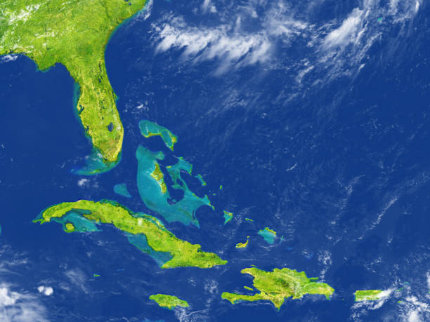
North Caribbean. 3D illustration with detailed planet surface. 3D model of planet created and rendered in Cheetah3D software, 7 Mar 2017. Some layers of planet surface use textures furnished by NASA, Blue Marble collection: http://visibleearth.nasa.gov/view_cat.php?categoryID=1484
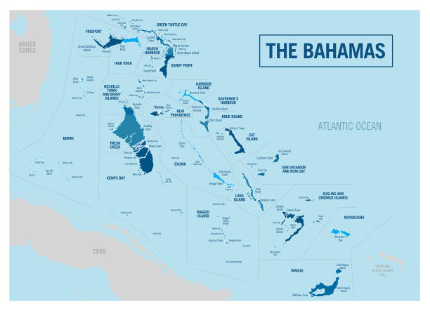
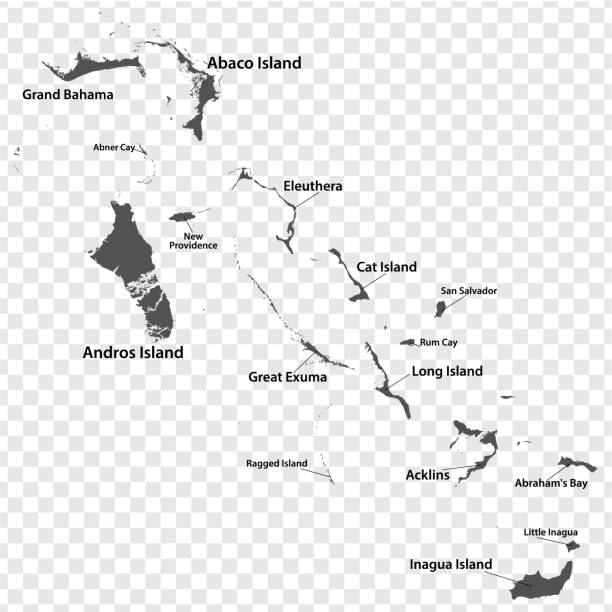
Detailed vector map of The Bahamas with administrative divisions. File was created on November 28, 2013. The colors in the .eps-file are ready for print (CMYK). Included files: EPS (v10) and Hi-Res JPG (5600 × 5600 px).
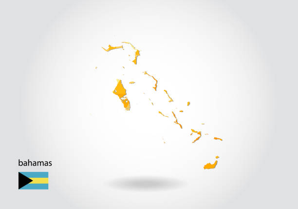
The Bahamas vector map with flag
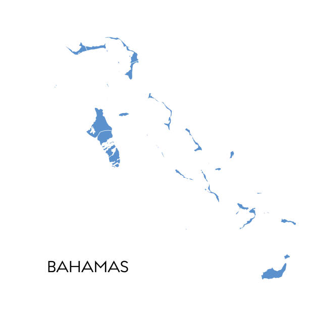
Vector illustration of the map of Bahamas
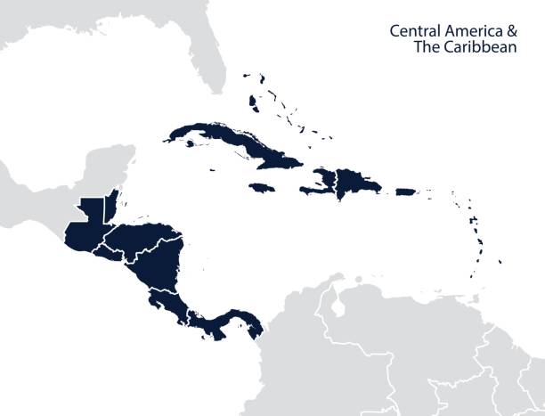
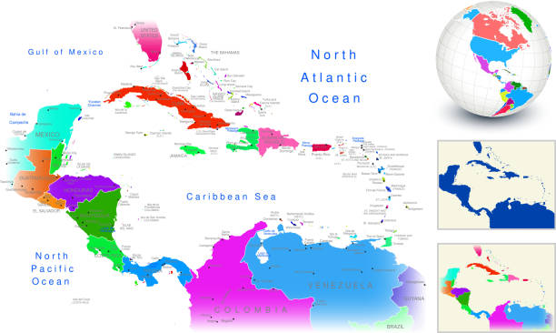
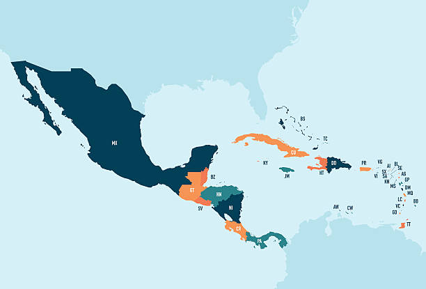
Central America and the Caribbean map. Vector
Empty Blue Map of Central America

The Caribbean, colored political map. Subregion of the Americas in the Caribbean Sea with its islands and English names. The Greater Antilles and the Lesser Antilles. Isolated illustration over white.
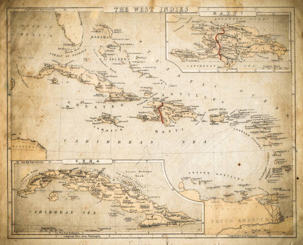
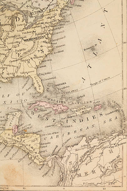
Cornell's Grammar School Geography By S.S. Cornell - New York 1869
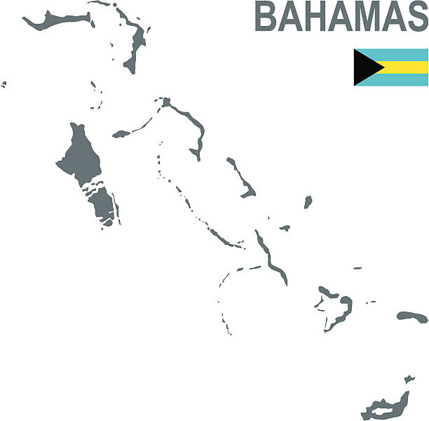
Bahamas Map with National Bahamian Flag and geographical borders
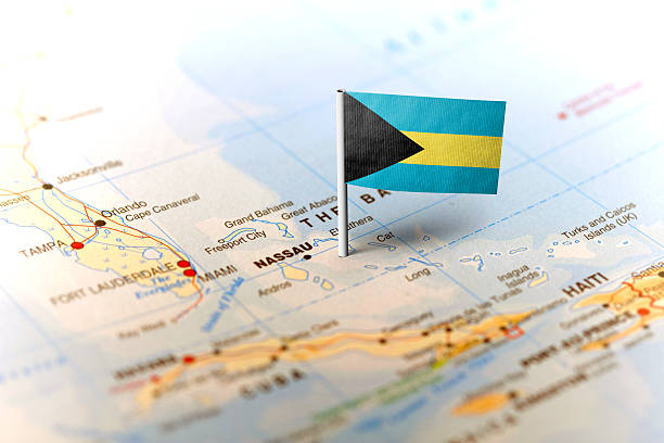
The flag of Bahamas pinned on the map. Horizontal orientation. Macro photography.
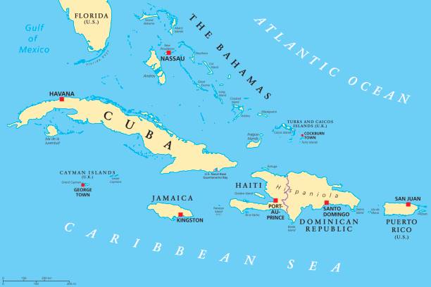
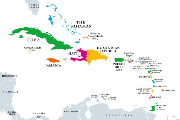
Greater Antilles political map. Caribbean islands. Cuba, Jamaica, Haiti, Dominican Republic, Puerto Rico, Cayman Islands, The Bahamas, Turks And Caicos Islands. Illustration. English labeling. Vector.
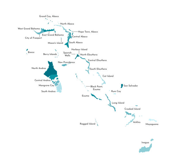
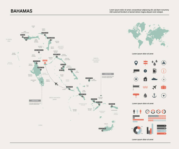
Detailed Bahamas map with navigation icons
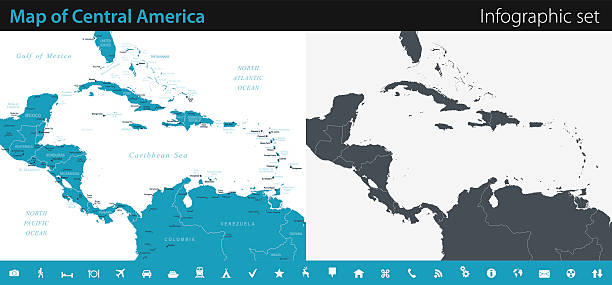
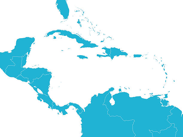
Vector maps of Central America with variable specification and icons
America with selected The Bahamas map and The Bahamas flag icon. Vector map and flag.
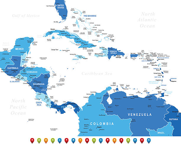
High detailed Map of Central America with national borders, countries and navigational icons
Vintage 1800's map with Carribean sea and Atlantic ocean and more.
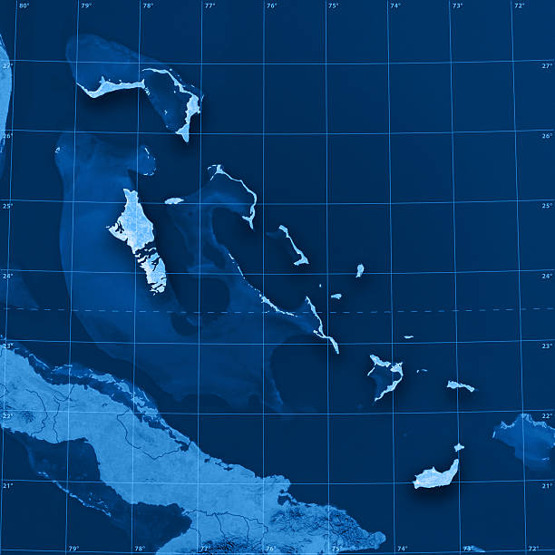
"3D render and image composing: Topographic Map of the Commonwealth of the Bahamas. Including country borders, rivers and accurate longitude/latitude lines. High quality relief structure!Relief texture and satellite images courtesy of NASA. Further data source courtesy of CIA World Data Bank II database.Related images:"
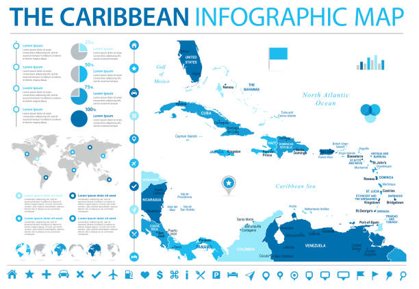
The Caribbean Map - Detailed Info Graphic Vector Illustration
http://dikobraz.org/map_2.jpgDetailed map of Bahamas with flag
Political map of Caribbean - Large And Lesser Antilles - with capitals, national borders, most important cities, rivers and lakes. Vector illustration with English labeling and scaling.
High quality map with borders of the regions
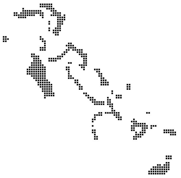
Bahamas map square dotted style, vector illustration
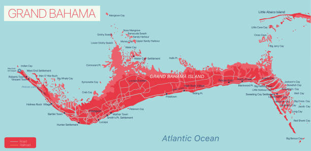
Grand Bahama island detailed editable map, vector EPS-10 file

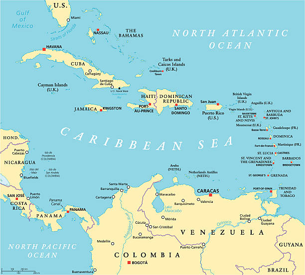
Caribbean political map with capitals, national borders, important cities, rivers and lakes. English labeling and scaling. Illustration.
World Geography Cewntral America
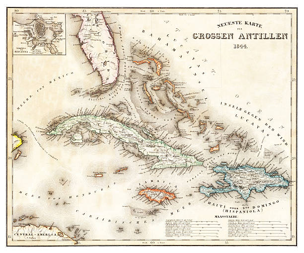
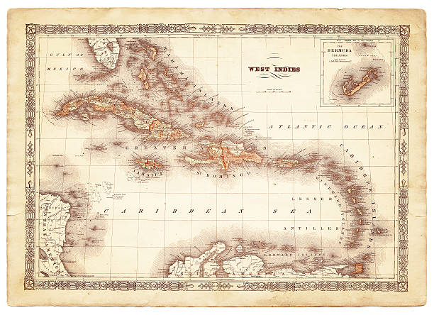
old map of the Caribbean and the West Indies from 1844
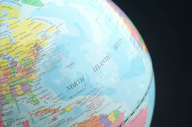
Globe view of Eastern Canada, U.S. and Atlantic Ocean.

Map of Cuba and Jamaıca.

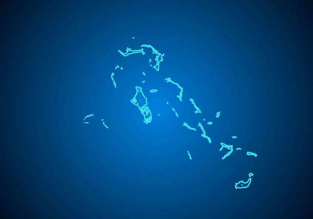
Bahamas map. Map of the country with beautiful geometric waves in red blue colors. Vivid Bahamas shape. Vector illustration.
http://dikobraz.org/map_2.jpg
The Caribbean countries political map with national borders. The Caribbean Sea with Greater, Lesser and Leeward Antilles, with West Indies and parts of Central and South America. English labeling.
Map and flag of Bahamas on weathered concrete
Colorful stylized vector map of Central America & the Caribbean with country name abbreviation labels. Countries can be individually selected.

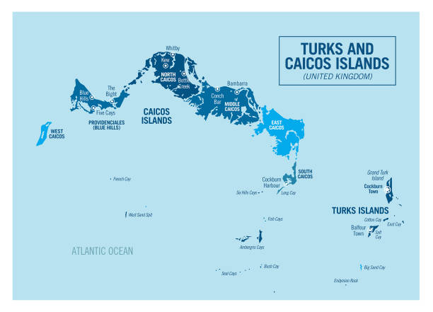
Map of Turks and Caicos Islands created with round blue dots on a blank background. Modern and trendy mosaic illustration. Vector Illustration (EPS10, well layered and grouped). Easy to edit, manipulate, resize or colorize.

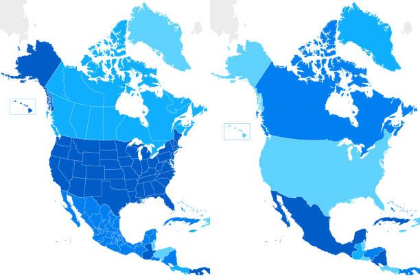
Blue map of North America with flag against white background. The url of the reference to political map is: http://www.lib.utexas.edu/maps/world_maps/united_states_foreign_service_posts-september_2011.pdf
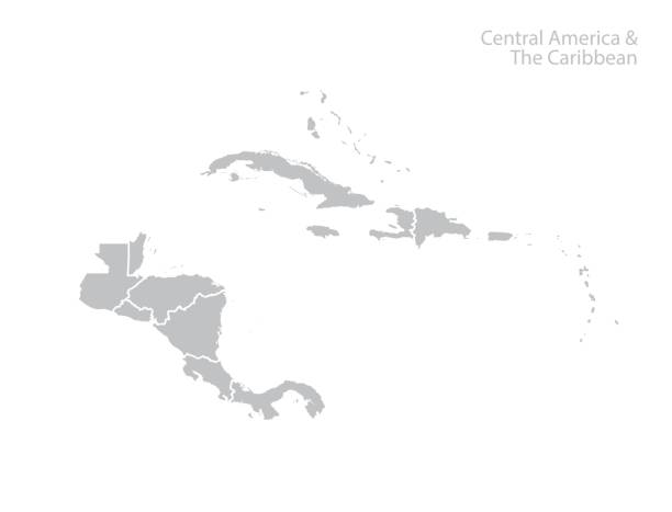
Central America and the Caribbean map. Vector