Six maps explain the boundaries of Israel and Palestinian territories
The political geography of Israel and the Palestinian territories has been changing for more than a century. British imperial control, wars, Jewish settlements and Israeli occupation have greatly shrunk the Palestinian people’s land area, while Israel has expanded its footprint. Both Palestinians and Israelis see the territory between the Jordan River and the Mediterranean Sea as their own, and Christians, Jews and Muslims all consider parts of the land sacred.
Here are the factors that have reshaped the map of the Middle East’s most contested territory over the past hundred or so years:
[The Israeli-Palestinian conflict: A chronology]


British control and involvement
In 1917, during World War I, Britain issued what is known as the Balfour Declaration, supporting the establishment of a “national home for the Jewish people” in Palestine, a Muslim-majority area with small Christian and Jewish populations. This declaration would become a central part of the British Mandate over Palestine. Jewish migration to Palestine began to increase.
After the war, the League of Nations — the predecessor of the United Nations — gave Britain administrative power over the area. In the decades that followed, there was a large influx of Jewish refugees from Europe as many fled Nazi persecution under Hitler and, during World War II, the Holocaust. The Jewish population in Palestine increased from 10 percent in 1917 to 30 percent in 1947 under the British Mandate. The majority-Palestinian population organized rebellions, fearing they would be displaced.
1 / 6
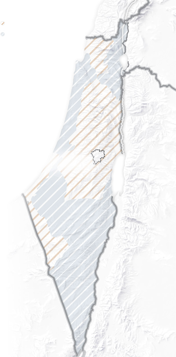
1947 U.N. partition plan
In 1947, as the end of the British Mandate neared, the United Nations proposed partitioning Palestine into a Jewish state and a smaller Palestinian state. Jerusalem — a holy site for Jews, Christians and Muslims — would be placed under an international trustee system. Palestinians rejected the proposal, which would have left them with less than half of their land and forced many from their homes. Zionist militias attacked Palestinian villages, causing thousands to flee.
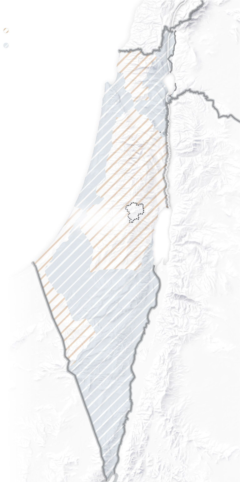
1948 Israeli independence and Palestinian displacement
When the state of Israel declared independence in 1948, neighboring Arab countries attacked, sparking the first Arab-Israeli war. It ended with Israel’s victory in 1949.
The conflict led to the displacement of 700,000 Palestinians, which became known to Palestinians and those sympathetic to them as the Nakba, or the catastrophe.
The area was then divided into three parts. The 1949 armistice line, or “Green Line,” made up the boundaries of Israel, the West Bank (the area west of the Jordan River) and the Gaza Strip. Until 1967, Egypt retained control of Gaza and Jordan retained control of the West Bank.
3 / 6
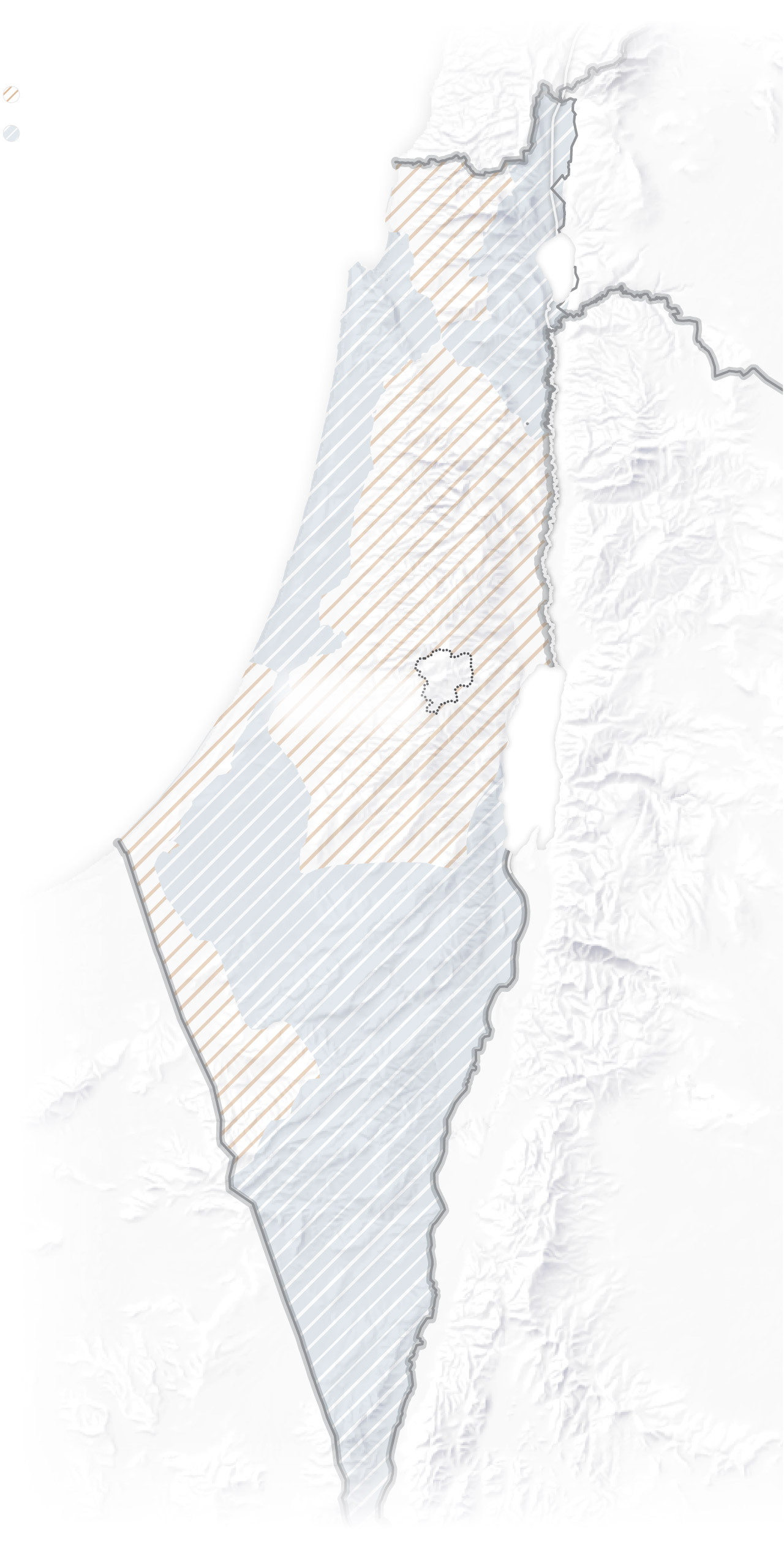
1967, 1973 wars
In 1967, another Arab-Israeli war ended with an Israeli victory. Israel defeated Egypt, Jordan and Syria, and occupied Gaza and the Sinai Peninsula, the West Bank, East Jerusalem and the Golan Heights.
In 1973, a coalition of Arab nations, led by Egypt and Syria, launched a surprise coordinated attack on Israel in what is known as the Yom Kippur War. The Arab coalition gained some ground but was eventually driven back by an Israeli counteroffensive. In 1978, the Camp David accords set a foundation for a peace agreement between Israel and Egypt, resulting in Israel’s withdrawal from the Sinai Peninsula in several stages, ending in 1982.
4 / 6
Annexations in the 1980s
In 1980, Israel passed the “Jerusalem Law,” formalizing the annexation of East Jerusalem and declaring the whole of Jerusalem as the Israeli capital. The United Nations said that the move violated international law and that the status of the city can be determined only through a negotiation process between Israelis and Palestinians. (In a reversal of long-standing U.S. policy, the United States recognized Jerusalem as Israel’s capital in 2017.)
Israel remained in the Golan Heights after the 1967 war and annexed it in 1981, although the move has not been internationally recognized. Israel invaded southern Lebanon in 1982 and occupied the region until 2000.
5 / 6
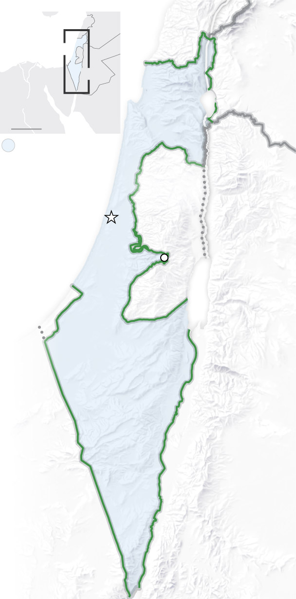
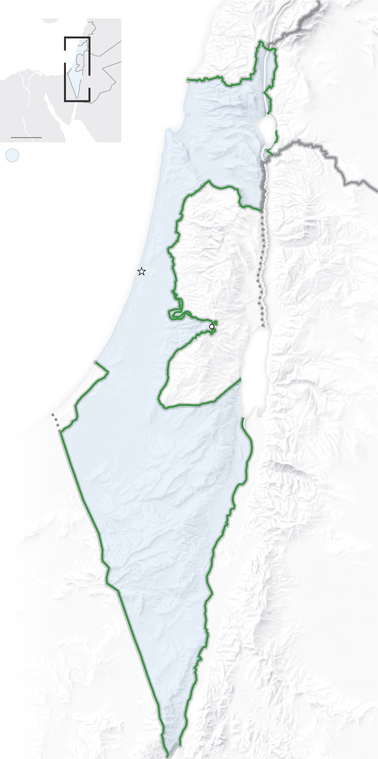
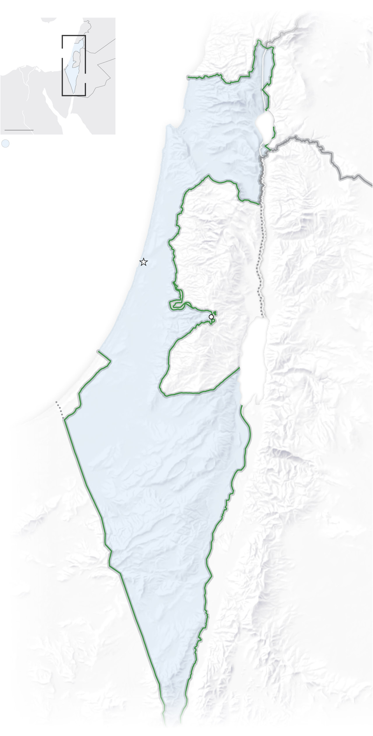
The West Bank and Gaza
In 1993, the first of the Oslo accords was signed and eventually resulted in limited self-governance for Palestinians in the West Bank and Gaza. In 1994, the West Bank was officially separated from Jordan as part of the Israel-Jordan peace treaty.
Today more than half a million Jewish settlers live in the West Bank on land once envisioned by the leaders at the Oslo talks as part of a future Palestinian state. Israel maintains full control over 60 percent of the area, with some roads that only Israelis can use and checkpoints that restrict the movements of Palestinians.
Israel withdrew troops from Gaza in 2005 after years of international pressure and sustained Palestinian protests, including two uprisings. When the militant group Hamas came to power in 2007, Israel imposed a crippling blockade on the enclave that was also enforced by Egypt.
6 / 6
correction
A previous version of this article incorrectly said the Balfour Declaration supported the establishment of a Jewish state. It supported “a national home for the Jewish people.” The article has been corrected. In addition, the article said the first Arab-Israeli war began after the state of Israel declared independence in 1948. That characterization of the war’s origins has been expanded to note that neighboring Arab countries attacked Israel after its declaration.
About this story
Modern-day boundaries sourced from the State Department. U.N. 1947 partition plan boundaries sourced from the United Nations. Armistice lines sourced from the U.N. Digital Library and the Israeli Ministry of Foreign Affairs. British and French mandate boundaries sourced from the Israeli Ministry of Foreign Affairs and the CIA via the Library of Congress. West Bank territory data sourced from the U.N. OCHA West Bank Access and Restrictions map dated May 2023.
Editing by Samuel Granados and Reem Akkad.