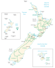
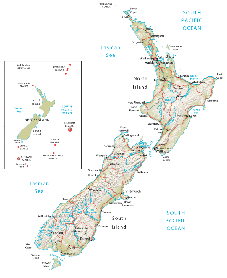
Map of New Zealand – Cities and Roads
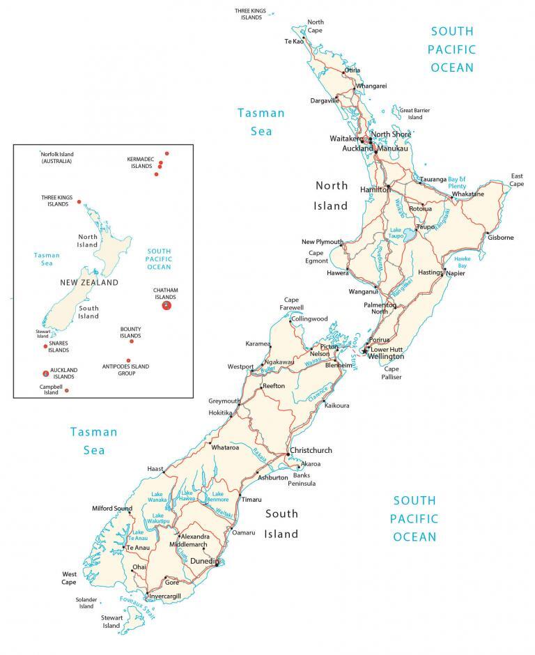
This New Zealand map displays major cities, towns, regions, roads, and rivers. It includes its two main islands, the Southern Alps, and Canterbury Plains in satellite imagery and an elevation map.
You are free to use our New Zealand map for educational and commercial uses. Attribution is required. How to attribute?
About the map
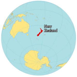
New Zealand is an island country in the South Pacific Ocean as part of Oceania. The country is known for rugby, kiwi, sheep, and its indigenous Maori culture. New Zealand is located to the southeast of Australia, which is separated by the Tasman Sea.
Also, the islands of Tonga, Fiji, Vanuatu, and New Caledonia are all close to New Zealand to the north. New Zealand is made up of two main islands – the North (Te Ika-a-Māui) and the South Island (Te Waipounamu), which are separated by the Cook Strait.
The South Island is the larger of the two islands and is less populous but contains the two major cities of Christchurch and Dunedin. Whereas the North Island is smaller in size but more populous with major cities like Auckland, Wellington, and Hamilton. Additionally, New Zealand’s capital city Wellington is located on the southwest corner of the North Island.
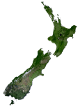
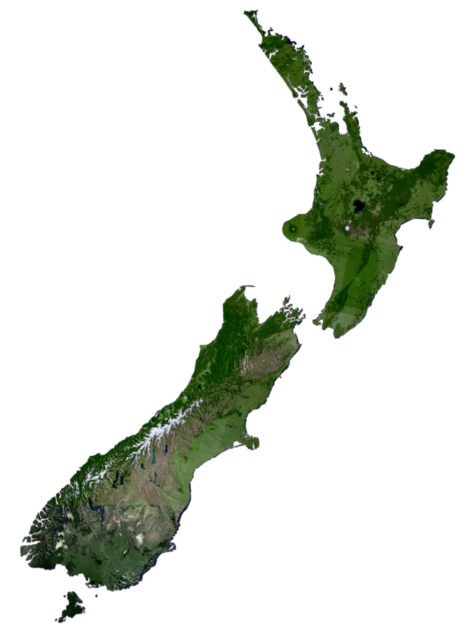
SATELLITE IMAGERY
New Zealand Satellite Map
Altogether, New Zealand occupies a total area of 268,710 square kilometers (103,750 sq mi), which makes it the sixth-largest island country in the world. The country contains an estimated 600 islands, including some of its largest like Stewart Island (Rakiura), Chatham Island, and Auckland Island.
Although deforestation has been an issue in New Zealand, forests cover 38 to 43% of the land area. At 3,487 square kilometers (1,346 sq mi), Lake Taupo is the largest lake, which is a caldera of a volcano on the North Island. Waikato River is the longest river which flows for about 425 km (264 mi) in length on the North Island as well.
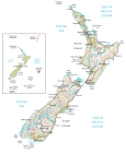
PHYSICAL MAP
New Zealand Physical Map
The terrain in New Zealand is mostly mountainous with large coastal plains. It’s the converging Australian and Pacific tectonic plates that have sculpted these mountain chains like the Southern Alps.
New Zealand is a land of beautiful landscapes and natural wonders. Mount Cook, or Aoraki as it is known in the Maori language, is an iconic natural landmark in New Zealand. It is the highest mountain in the country, standing at 3,724 meters (12,218 feet)
Other notable geographic features are the Kaikoura Ranges which lie to the northeast, and the Canterbury Plains to the east. Additionally, the West Coast is indented with its rough coastlines like the Fiordland. All these types of landscapes created the ideal setting for the setting of the Lord of the Rings. Because of its tectonic movement, the risk of earthquakes, tsunamis, and volcanic activity is high.
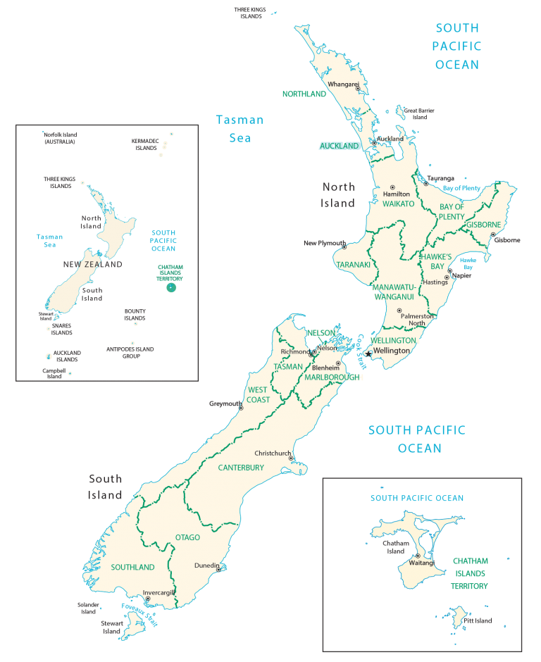
POLITICAL MAP
New Zealand Regions Map
Regions are the first-level administrative units in New Zealand that are divided geographically and administratively. Currently, 16 regions are part of New Zealand. While eleven of the regions have regional councils, five have territorial authority. The second-level administration units are districts. But they are not subdivisions of regions. Instead, they have their own geographic boundary and can fall into one or more regions.
Capital City
Wellington
Major islands
North Island
South Island
Major cities and towns
Auckland
Christchurch
Dunedin
Hamilton
Lower Hutt
Napier
Palmerston North
Tauranga
Cities, towns and villages
Akaroa
Alexandra
Ashburton
Blenheim
Collingwood
Dargaville
East Cape
Gisborne
Gore
Greymouth
Haast
Hastings
Hawera
Hokitika
Invercargill
Kaikoura
Karamea
Manukau
Middlemarch
Milford Sound
Nelson
New Plymouth
Ngakaway
North Shore
Oamaru
Ohai
Otiria
Picton
Porirua
Reefton
Rotorua
Taupo
Te Anau
Te Kao
Timaru
Waitakere
Wanganui
Westport
Whakatane
Whangarei
Whataroa
Lakes, rivers and water features
Bay of Plenty
Buller River
Clarence River
Cook Strait
Foveaux Strait
Hawke Bay
Lake Benmore
Lake Hawea
Lake Taupo
Lake Te Anau
Lake Wakatipu
Lake Wanaka
Rakaia River
Rangitikei River
South Pacific Ocean
Tasman Sea
Tasman Sea
Waikato River
Wairau River
Waitaki River
Islands
Antipodes Island
Auckland Islands Group
Bounty Islands
Campbell Island
Chatham Islands
Great Barrier Island
Kermadec Islands
Snares Islands
Solander Island
Stewart Island
Stewart Island
Three Kings Islands
Landforms and geographic regions
Banks Peninsula
Cape Egmont
Cape Farewell
Cape Palliser
North Cape
West Cape


